Mar 20, 2023
Saturday 3/11, 2023
Flow in Hayden Meadows: ~50 cfs and Icy.
Flow at Granite: 132 cfs.
Water Temp.: 30s-low 40s.
Clarity: Still some shelf ice near Leadville but very approachable near Buena Vista.
2023 Fly Fishing 101 Dates: March 18, April 1, April 15, April 29, May 13, May 27, June 10
2023 Rowing School: March 22-26
Saturday Report - Braden Baker
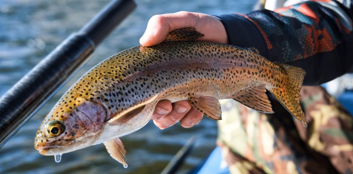
The upper river is offering plenty of open water now, with nearly all public access points yielding open, fishable water and fish that are more eager by the day. We're still seeing more consistency further downstream, but warm days are becoming very worthwhile above Buena Vista. Expect fish to be lethargic in the morning hours but to resume feeding activity mid-day on the warmer days. Much of the upper basin will appear devoid of fish, as a select few winter pools will hold the majority of trout. Prime hours here are normally 11AM-3PM when the sun is on the water. Prospecting the best water with a tandem fly rig is very efficient, pairing a small midge larva/pupa, baetis nymph, or caddis larva with a much larger stonefly or attractor nymph to cover your main food groups. Expect active fish to offer very subtle strikes in the cold water.
Follow us on instagram at @ArkAnglers!
Salida Location - 7500 W. Highway 50, Salida, CO 81201. (719) 539-3474.
Open Monday-Saturday, 8:00am-6:00pm. Sunday 8:00am-5:00pm.
Buena Vista Location - 517 S. Highway 24, Buena Vista, CO 81211. (719) 395-1796.
Open Tuesday-Saturday, 8:00am-6:00pm. Sunday 8:00am-5:00pm. Closed on Monday.
Please call us at 719-539-4223 with questions or to make your reservation.
Hayden Meadows comprises about eight miles of river flowing through high meadow country south of Leadville. Located upstream of the confluence with Lake Creek, Hayden Meadows is spared the impact of the native and imported water that is released through the summer from Twin Lakes. As a result, peak flows on this section of the river are typically only about a third of what we see in Salida and the native runoff is relatively short-lived. Characterized by meandering oxbows, grassy cut banks, and phenomenal views of Mt. Elbert and the Mount Massive Wilderness, Hayden Meadows is a high elevation summer fishery that is home to excellent hatches and some very healthy brown trout.
Special Regulations Apply – Artificial flies and lures only. Limit is one trout, 12 inches or less.
As one travels downstream, the slower current velocity and grassy banks of Hayden Meadows are left behind for the bouldered pocket water of the Granite Gorge. Here one exchanges the cobblestone bars and shelf lines for a riverbed strewn with rocks of every size, creating rapids and eddies, shoreline pockets and deep plunge pools. Set astride the upper end of this canyon, from the Lake County line downstream to 1.5 miles below the Granite Bridge, the Granite State Wildlife Area provides public access above and beyond that afforded by the San Isabel National Forest. Most anglers do not wade far into this swifter, steeper current but rather rock-hop along the bank, working the shoreline habitat and seamlines where the predominant brown trout population primarily resides.
Upstream of Buena Vista, along the east side of the river, County Road 371 provides areas of public fishing access to the Arkansas. In particular, the “Tunnel Section”, where the road passes through several tunnels left over from the Midland Railroad line, provides a significant reach of water with good shoreline access. Though not as steep as the Granite Gorge, the Tunnels and the section of river accessed near the Railroad Bridge campground upstream contain swift moving pocket water and some deep green runs where rapids plunge into pools. As above, most anglers on this section of the river keep to the edges, where many of the river’s brown trout reside outside of the faster water.
There is a significant segment of public river access above and below the Buena Vista whitewater park and boat ramp, out at the east end of Main Street. There is parking and restrooms at the top of the boat ramp. The source for fly-fishing equipment and information in Buena Vista is the ArkAnglers shop, located at 517 S. Highway 24 (719-395-1796).
The Crystal Lakes are located on the west side of US 24 about six miles south of Leadville, a few miles north of where Highway 24 crosses over the Arkansas River and the railroad. The lakes adjoin the Reddy State Wildlife Area on the Arkansas River at the upstream end of public access to the Hayden Meadows area. The Crystal Lakes are considered mid-elevation lakes, fed by springs and a tributary stream, and typically ice-off in mid-May. Rich in midges and mayflies, the lake is home to both a healthy resident trout population and regularly stocked rainbows. A good alternative when high flows muddy even the uppermost end of the river, the Crystal Lakes has a good damselfly hatch in June.
Though its flows are mostly diverted to Forebay and Twin Lakes, and hence, rarely impact the quantity or quality of water in the Arkansas River, Halfmoon Creek is of interest as a tributary fishery to the Arkansas River and, because it has a USGS flow gauge on it, as a representative upper basin tributary for purposes of comparison. By reviewing flows on Halfmoon Creek, one can get a fair idea what similar tributary streams that arise from the northern Sawatch range are doing, in terms of percent of average flow and degree of daily fluctuation due to snowmelt. Draining the extensive valley between Mt. Elbert and Mt. Massive and bordering on the Mt. Massive Wilderness, Halfmoon Creek is also a summer fishing destination in its own right with two campgrounds and access by trail and primitive road.
This is a short, steep reach of stream that flows through private land from Twin Lakes to the mainstem of the Arkansas River below Hayden Meadows. Unimportant as a fishery, the flows discharging from Twin Lakes have a pronounced effect on the river, often doubling or tripling the flow in the upper Arkansas at its confluence. This disproportionate impact is seen in the winter, when the Bureau of Reclamation moves water downstream to make room for both native and imported runoff, and during the summer, when “pass through runoff” in June, and water for recreational flow augmentation in July and August, are released into the mainstem of the Arkansas River.
Even shorter than the outflow from Twin Lakes, Clear Creek Reservoir basically empties directly into the Arkansas River 3-4 miles downstream of Granite. And though impacting the flows on the Arkansas far less than Lake Creek, the reservoir is still capable of releasing an additional 350 cfs into the river. This release can create a short-lived “tailwater effect” below the confluence, adding clear water to the murky Arkansas during runoff.
The several forks of Cottonwood Creek drain a large area of the middle Sawatch Range, including the southern part of the Collegiate Peaks Wilderness. Among the different branches, South Cottonwood Creek probably offers the most for the fly-fisherman, with a gentler gradient and more beaver ponds than the other forks. There are also two USFS campgrounds and plenty of primitive camping in this basin. Additionally, Cottonwood Lake, an impoundment about four miles up the creek from the confluence with the Middle Fork, has a nice population of resident fish and is regularly stocked by Parks and Wildlife. The lake is well-suited to fishing from a float-tube, canoe, or kayak and there is a boat ramp adjacent to where the creek flows in to the west end of the lake.
Just east of Jones Mountain on the Gladstone Ridge separating the Middle and South Forks of Cottonwood Creek, Ptarmigan Lake (about 12,000 ft) provides intrepid hikers with some exercise, spectacular scenery, and the chance at some significant high elevation cutthroats. With trails accessing it from both the north and south, Ptarmigan gets a fair bit of mid-summer traffic. But for those able to hit it soon after ice-out, usually near the end of June, the lake provides some memorable days of fishing. Ptarmigan is also a good indicator lake – conditions there are generally reflective of other lakes of similar elevation in the middle Sawatch Range.